About
This registry exists to help people discover and share collections that are available via Sentinel Hub.
- See all usage examples for collections listed in this registry tagged with planetary variables
- New: Planet Sandbox Data Collections
Search collections (currently 13 matching collections)
You are currently viewing a subset of data tagged with planetary variables.
Add to this registry
If you want to add a collection or example of how to use a collection to this registry, please follow the instructions on the Sentinel Hub Collections GitHub repository.
Unless specifically stated in the applicable collection's documentation, collections available through the Sentinel Hub Collections are not provided and maintained by Sentinel Hub. Collections are provided and maintained by a variety of third parties under a variety of licenses. Please check collection licenses and related documentation to determine if a collection may be used for your application.
Crop Biomass
agriculturebiomasscommercial dataopen dataplanetary variablessatellite imagery
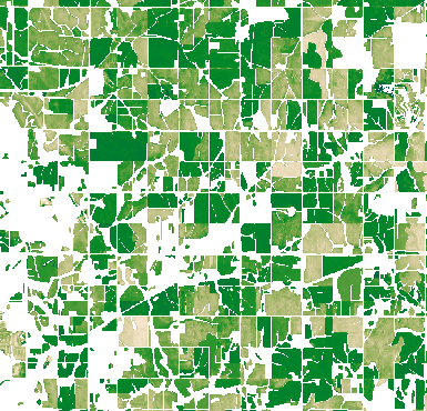
Crop Biomass provides the ability to track and respond to the highly dynamic nature of biomass in agricultural fields throughout the season. This enables better-informed decisions, input optimization, interventions, and harvest planning. This is a relative measure of biomass, so each pixel value has a value of 0 (low biomass) to 1 (high biomass). The product is provided daily and every day, the user gets a new raster with the data from the most updated direct observation from the day before.
Land Surface Temperature
agriculturecommercial dataplanetary variablessandbox datasatellite imagerythermal
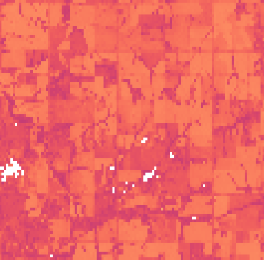
Planet’s Land Surface Temperature (LST) is a feed of high-resolution, globally available measurement of the skin temperature of the Earth. Combining observations from a range of satellite constellations, Land Surface Temperature is not hindered by clouds, ensuring a continuous, consistent and scientifically reliable data record of more than 20 years. Consequently, there is no requirement to uphold extensive networks of physical sensors. This Planetary Variable measures the temperature twice a day (daytime and nighttime) with a spatial resolution of 100 m and 1000 m, providing vital intelligenc...
Soil Water Content
agriculturecommercial datadroughtplanetary variablessandbox datasatellite imagery
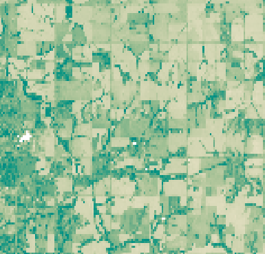
The Soil Water Content is the measure of the amount of water present in a unit volume of soil. It is typically expressed as a percentage and represents the ratio between the volume of water and the total volume of the soil. This measurement is crucial for understanding the water status of the soil and provides information on factors such as drought monitoring, soil health and hydrological processes. The Soil Water Content Planetary Variable measures the water content of the soil almost daily with a spatial resolution of 100 m and 1000 m. It is not affected by clouds and has a long and cons...