WorldCover
Short description
The European Space Agency (ESA) WorldCover is a global land cover map with 11 different land cover classes produced at 10m resolution based on combination of both Sentinel-1 and Sentinel-2 data. In areas where Sentinel-2 images are covered by clouds for an extended period of time, Sentinel-1 data then provides complimentary information on the structural characteristics of the observed land cover. Therefore, the combination of Sentinel-1 and Sentinel-2 data makes it possible to update the land cover map almost in real time. WorldCover Map was first produced for 2020 using v100 of the algorithm and later for 2021 with v200 algorithm. Due to the different algorithm versions, it should be noted that changes between WorldCover map 2020 and WorldCover map 2021 are a result of both actual changes in land cover and in the used algorithm. WorldCover map is provided as part of the 5th Earth Observation Envelope Programme (EOEP-5). It provides global coverage of valuable information for applications such as biodiversity, food security, carbon assessment and climate modelling. More information can be found on the
WorldCover website and the
2020 v100 Product user Manual and
2021 v200 Product user Manual
WorldCover product has 1 band named
Map. The values of this band are described below.
WorldCover Map classes description
| Value |
Color |
Color Code |
Class Name |
| 10 |
|
0x006400 |
Tree cover |
| 20 |
|
0xffbb22 |
Shrubland |
| 30 |
|
0xffff4c |
Grassland |
| 40 |
|
0xf096ff |
Cropland |
| 50 |
|
0xfa0000 |
Built up |
| 60 |
|
0xb4b4b4 |
Bare /sparse vegetation |
| 70 |
|
0xf0f0f0 |
Snow and Ice |
| 80 |
|
0x0064c8 |
Permanent water bodies |
| 90 |
|
0x0096a0 |
Herbaceous wetland |
| 95 |
|
0x00cf75 |
Mangroves |
| 100 |
|
0xfae6a0 |
Moss and lichen |
| 0 |
|
|
No data |
Representative Images
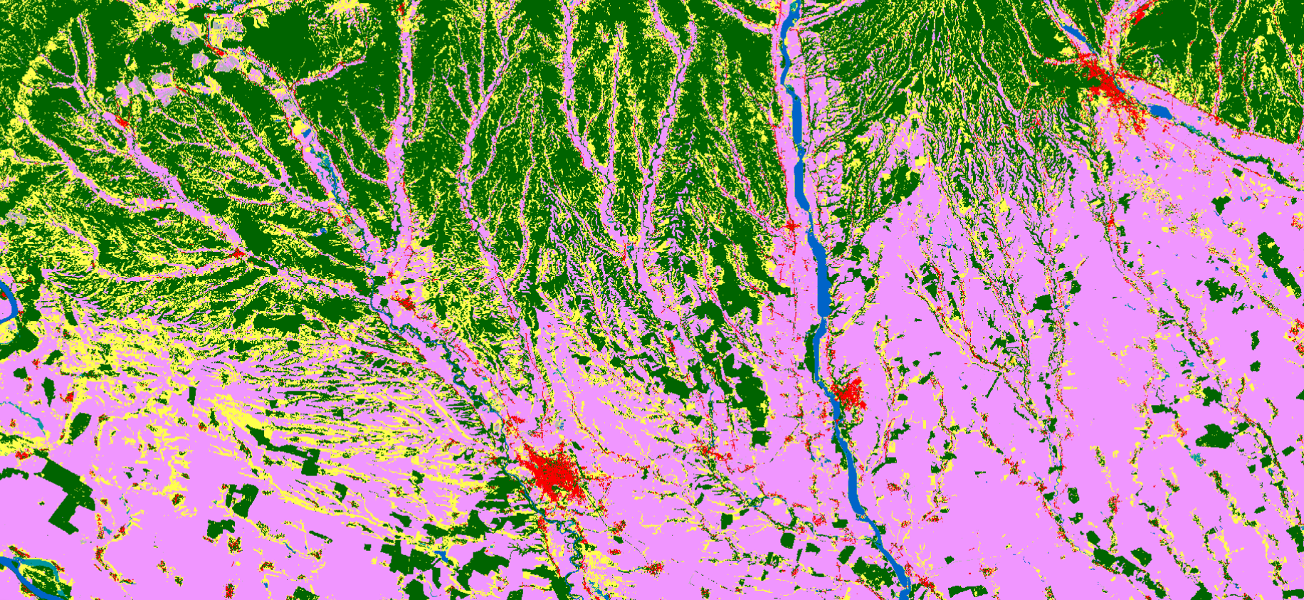 WorldCover 2020, river Olt, South of Romania visualised in EO Browser.
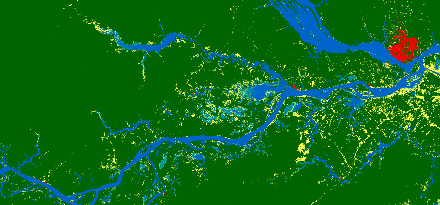 WorldCover 2020, Manaus Amazonas Brazil visualised in EO Browser