10m Annual Land Use Land Cover (9-class)
Short description
The 10m Annual Land Use Land Cover (LULC) map is produced Impact Observatocy, Microsoft, and Esri collaboratively.
The data collection is derived from ESA Sentinel-2 imagery at 10m resolution globaly using Impact Ovservatory's state of the art deep learning AI land classification model which is trained by billions of human-labeled image pixels.
There are 9 LULC classes generated by the algorithm, including Built, Crops, Trees, Water, Rangeland, Flooded Vegetation, Snow/Ice, Bare Ground, and Clouds.
The 10m Annual Land Use Land Cover product contains 1 band. The values of this band are described below.
10m Annual Land Use Land Cover classes description
| Value |
Color |
Color Code |
Label |
| 1 |
|
0x419bdf |
Water |
| 2 |
|
0x397d49 |
Trees |
| 4 |
|
0x7a87c6 |
Flooded Vegetation |
| 5 |
|
0xe49635 |
Crops |
| 7 |
|
0xc4281b |
Built Area |
| 8 |
|
0xa59b8f |
Bare Ground |
| 9 |
|
0xa8ebff |
Snow/Ice |
| 10 |
|
0x616161 |
Clouds |
| 11 |
|
0xe3e2c3 |
Rangeland |
The
product documentation can be found on
Impact Observatory and are available on
AWS.
Representative Images
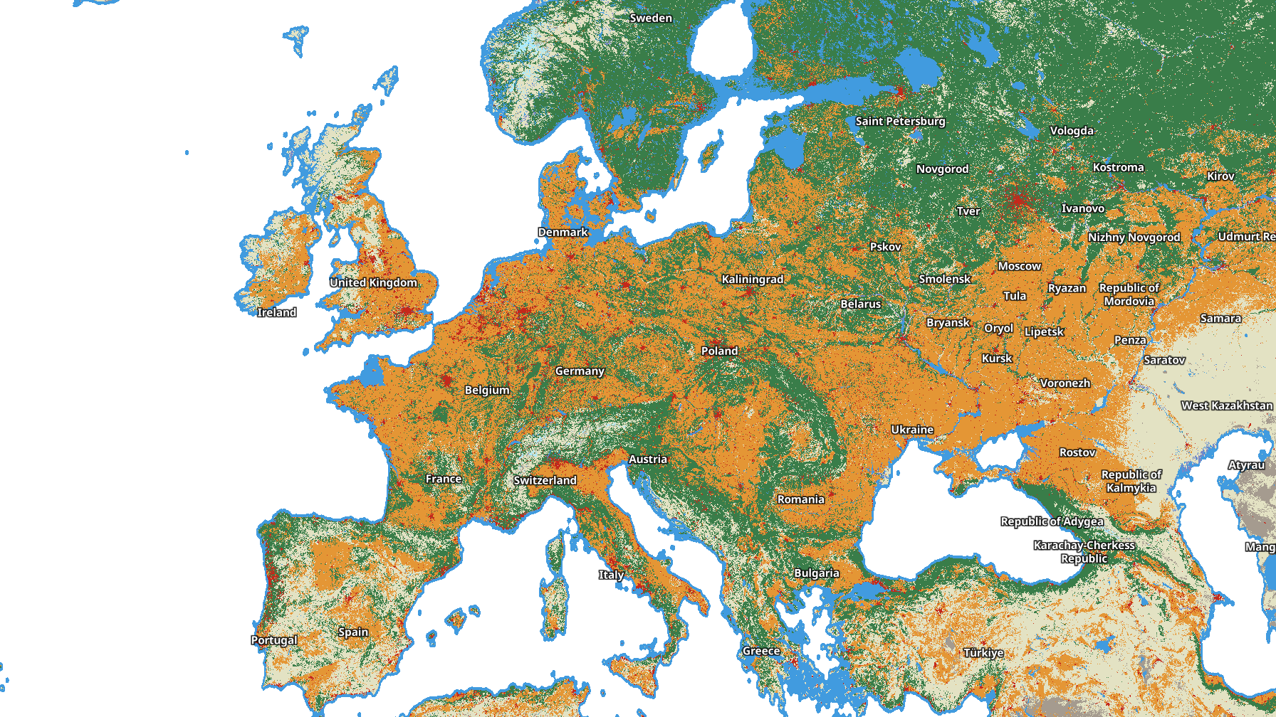 10m Annual Land Use Land Cover 2021, Europe visualised in EO Browser.
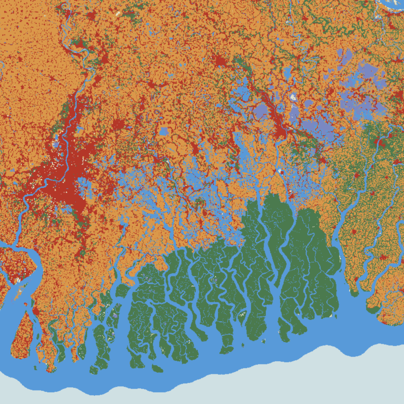 10m Annual Land Use Land Cover 2022, Ganges Delta visualised in EO Browser.