River and Lake Ice Extent - Sentinel 1
Short description
The River and Lake Ice Extent - Sentinel 1 (RLIE S1) product is part of the Copernicus Land Monitoring Service (CLMS),
pan-European High Resolution Snow and Ice Monitoring
(HR-S&I) Ice product suite.The River and Lake Ice Extent (RLIE) products measure the presence of ice in rivers and lakes described by the EU-HYDRO network database, in particular the area of snow-free or snow-covered ice.
The RLIE S1 product is released in near real time for the entire EEA39 zone based on the revisit time of the Sentinel 1 syntetic aperture radar constellation (~ 6 days at the equator and ~1 to 3 days in European countries), and it is generated at a spatial resolution of 20 m x 20 m. Because it is time critical for several applications, every effort is made to provide near real time ice products between 6 and 12 hours after the data sensing time.
More information about the RLIE S1 product methodology and workflow is outlined in the
product user manual. A detailed explanation about the accuracy of the product can be found in the
quality assessment report.
The RLIE S1 contains three layers: (1) the extent of rivers and lakes, (2) quality layer with confidence levels (QC), and (3) quality flags (QCFLAGS).
River and Lake Ice Extent symbology (RLIE)
| Value |
Symbol |
Label |
| 1 |
|
Open water |
| 100 |
|
Snow-covered or snow-free ice |
| 255 |
|
No data |
Confidence levels symbology (QC)
| Value |
Symbol |
Label |
| 0 |
|
High quality |
| 1 |
|
Medium quality |
| 2 |
|
Low quality |
| 3 |
|
Minimal quality |
| 255 |
|
No data |
Quality flags (QCFLAGS)
| Value |
Label |
| bit 1 |
Dimension flag |
| bit 2 |
Standing water flag |
| bit 3 |
Radar shadow flag |
| bit 4 |
Temporary water flag |
| bit 5 |
Imperviousness flag |
| bit 6 |
Tree cover density flag |
| bit 7 |
Grassland flag |
Representative Images
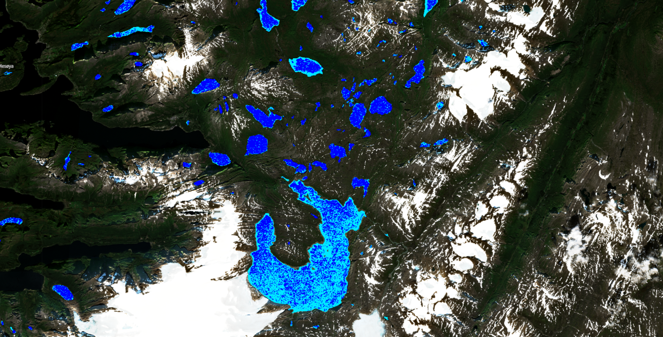 Sentinel 1 River and Lake Ice Extent, 2023, Nordland, Norway.
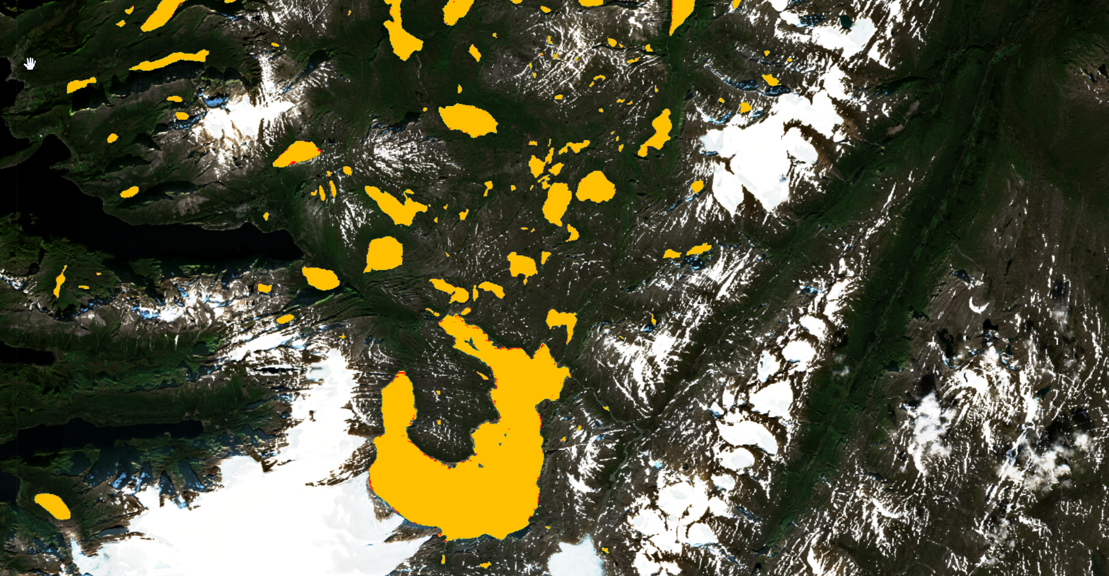 Confidence levels of the Sentinel 1 River and Lake Ice Extent, 2023, Nordland, Norway.